Fail:NepalBankeDistrictmap.png
Fail asli (3,508 × 2,479 piksel, saiz fail: 250 KB, jenis MIME: image/png)
| Keterangan |
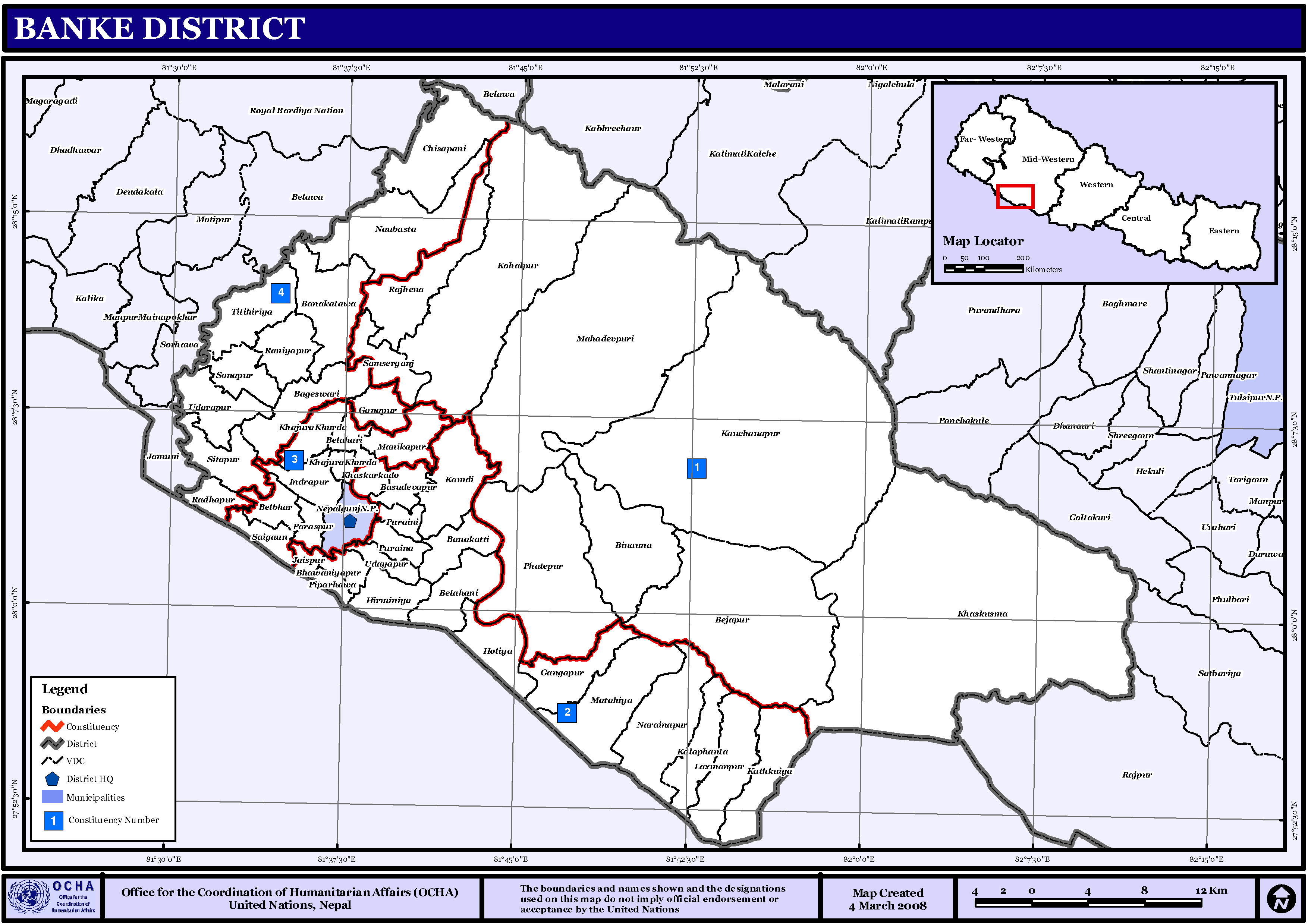
English: Map displaying Village Development Committees in Banke District, Nepal |
|||
| Tarikh | ||||
| Sumber | http://www.un.org.np/maps/district-maps/mid-western/Banke.pdf | |||
| Pengarang | United Nations | |||
| Kebenaran (Penggunaan semula fail ini) |
|

Sejarah fail
Klik pada tarikh/waktu untuk melihat rupa fail tersebut pada waktu itu.
| Tarikh/Waktu | Gambar kenit | Ukuran | Pengguna | Komen | |
|---|---|---|---|---|---|
| semasa | 01:42, 6 November 2008 | | 3,508 × 2,479 (250 KB) | Sadalmelik | {{Information |Description={{en|1=Map displaying Village Development Committees in Banke District, Nepal}} |Source=http://www.un.org.np/maps/district-maps/mid-western/Banke.pdf |Date=March 4, 2008 |Author=United Nations |Permission={{PD-UN}} |other_ve |
Penggunaan fail
Laman berikut menggunakan fail ini:
Penggunaan fail sejagat
Fail ini digunakan oleh wiki-wiki lain yang berikut:
- Penggunaan di de.wikipedia.org
- Penggunaan di en.wikipedia.org
- Penggunaan di fi.wikipedia.org
- Penggunaan di mai.wikipedia.org
- बाँके जिला
- आकृति:बाँके जिलाक नगरपालिका तथा गाविससभ
- इन्द्रपुर, बाँके
- आकृति:बाँके जिलाक गाविससभ तथा नगरपालिकासभ
- उदयपुर, बाँके
- उढरापुर
- कचनापुर
- कम्दी
- कटकुंईया
- कालाफांटा
- खजुराखूर्द
- खासकारकांदो
- खासकुस्मा
- गनापुर
- गङ्गापुर
- चिसापानी, बाँके
- जयसपुर
- टिटिहिरिया
- नरैनापुर
- नौबस्ता
- परस्पुर
- पिप्रहवा
- पुरैनी
- पुरैना
- फत्तेपुर, बाँके
- बनकट्टी
- बनकट्वा
- बिनौना
- बेतहनी
- बेलहरी
- बेलभार
- बैजापुर
- भवानियापुर
- मटेहिया
- मनिकापुर
- महादेवपुरी
- रनियापुर
- राधापुर
- लक्ष्मणपुर
- वसुदेवपुर
- वागेश्वरी
- शमसेरगञ्ज
- साईगाँउ
- सीतापुर, बाँके
- सोनपुर, बाँके
Lihat banyak lagi penggunaan sejagat bagi fail ini.