Fail:MountAkutan.jpg

Saiz pralihat ini: 800 × 538 piksel. Leraian-leraian lain: 320 × 215 piksel | 640 × 430 piksel | 1,024 × 688 piksel.
Fail asli (1,024 × 688 piksel, saiz fail: 247 KB, jenis MIME: image/jpeg)
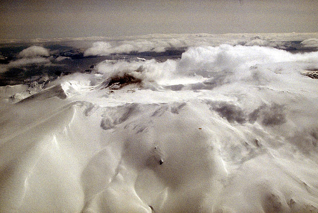
Aerial view of Akutan volcano that forms the west part of Akutan Island in the eastern Aleutian Islands. The volcano's summit is truncated by a 2-km-wide (1.2 mi) caldera that contains a cinder cone that has been the site of frequent historical eruptions. View is to the southeast.
Photograph by C. Nye, Alaska Division of Geological and Geophysical Surveys, May 10, 1994. Source: http://geopubs.wr.usgs.gov/dds/dds-40/
This image is in the public domain in the United States because it only contains materials that originally came from the United States Geological Survey, an agency of the United States Department of the Interior. For more information, see the official USGS copyright policy.
|
Sejarah fail
Klik pada tarikh/waktu untuk melihat rupa fail tersebut pada waktu itu.
| Tarikh/Waktu | Gambar kenit | Ukuran | Pengguna | Komen | |
|---|---|---|---|---|---|
| semasa | 12:55, 28 Januari 2005 | | 1,024 × 688 (247 KB) | GarciaB~commonswiki | Mount Akutan, Alaska |
Penggunaan fail
Laman berikut menggunakan fail ini:
Penggunaan fail sejagat
Fail ini digunakan oleh wiki-wiki lain yang berikut:
- Penggunaan di ca.wikipedia.org
- Penggunaan di ceb.wikipedia.org
- Penggunaan di cs.wikipedia.org
- Penggunaan di de.wikipedia.org
- Penggunaan di en.wikipedia.org
- Penggunaan di es.wikipedia.org
- Penggunaan di eu.wikipedia.org
- Penggunaan di fi.wikipedia.org
- Penggunaan di ga.wikipedia.org
- Penggunaan di gv.wikipedia.org
- Penggunaan di hy.wikipedia.org
- Penggunaan di it.wikipedia.org
- Penggunaan di nl.wikipedia.org
- Penggunaan di no.wikipedia.org
- Penggunaan di uk.wikipedia.org
- Penggunaan di ur.wikipedia.org
- Penggunaan di www.wikidata.org
- Penggunaan di zh.wikipedia.org