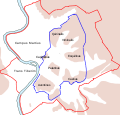
Fail:Roma Plan.jpg

Saiz pralihat ini: 754 × 600 piksel. Leraian-leraian lain: 302 × 240 piksel | 604 × 480 piksel | 966 × 768 piksel | 1,280 × 1,018 piksel | 1,840 × 1,463 piksel.
Fail asli (1,840 × 1,463 piksel, saiz fail: 2.5 MB, jenis MIME: image/jpeg)
Sejarah fail
Klik pada tarikh/waktu untuk melihat rupa fail tersebut pada waktu itu.
| Tarikh/Waktu | Gambar kenit | Ukuran | Pengguna | Komen | |
|---|---|---|---|---|---|
| semasa | 16:14, 30 Mac 2015 |  | 1,840 × 1,463 (2.5 MB) | Jonstevn | Reverted to version as of 19:01, 28 August 2006 |
| 16:10, 30 Mac 2015 |  | 1,840 × 1,463 (2.5 MB) | Jonstevn | Reverted to version as of 19:01, 28 August 2006 | |
| 16:10, 30 Mac 2015 |  | 1,840 × 1,463 (2.5 MB) | Jonstevn | Reverted to version as of 19:01, 28 August 2006 | |
| 06:40, 27 Julai 2008 |  | 1,840 × 1,463 (3.38 MB) | Amadscientist | {{Information |Description= |Source= |Date= |Author= |Permission= |other_versions= }} | |
| 04:57, 27 Julai 2008 |  | 4,000 × 3,180 (12.21 MB) | Amadscientist | {{Information |Description= |Source= |Date= |Author= |Permission= |other_versions= }} | |
| 19:01, 28 Ogos 2006 |  | 1,840 × 1,463 (2.5 MB) | Nikephoros | {{Information |Description=Plan Roms im Altertum / Map of Rome during Antiquity |Source=G. Droysens Allgemeiner Historischer Handatlas |Date=1886 |Author=? |Permission= not needed |other_versions= no }} |
Penggunaan fail
Laman berikut menggunakan fail ini:
Penggunaan fail sejagat
Fail ini digunakan oleh wiki-wiki lain yang berikut:
- Penggunaan di ar.wikipedia.org
- Penggunaan di as.wikipedia.org
- Penggunaan di azb.wikipedia.org
- Penggunaan di beta.wikiversity.org
- Penggunaan di bg.wikipedia.org
- Penggunaan di bn.wikipedia.org
- Penggunaan di bs.wikipedia.org
- Penggunaan di bxr.wikipedia.org
- Penggunaan di ca.wikipedia.org
- Penggunaan di ceb.wikipedia.org
- Penggunaan di cs.wikipedia.org
Lihat banyak lagi penggunaan sejagat bagi fail ini.


