Fail:Moheli (Comoros) map.jpg

Tiada leraian lebih besar.
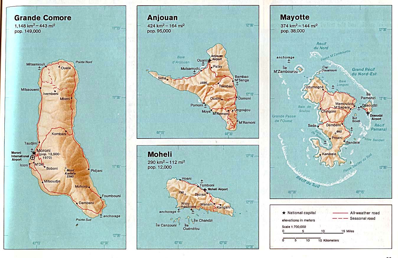
Moheli_(Comoros)_map.jpg (354 × 320 piksel, saiz fail: 19 KB, jenis MIME: image/jpeg)
Ringkasan
| Keterangan | Moheli. From The Indian Ocean Atlas, CIA, 1976. |
| Tarikh | |
| Sumber | University of Texas Libraries, Perry-Castañeda Library Map Collection: Comoros Maps (extracted) |
| Pengarang | CIA |
| Versi lain |

_map.jpg)
Perlesenan
| This image is a work of a Central Intelligence Agency employee, taken or made as part of that person's official duties. As a Work of the United States Government, this image or media is in the public domain in the United States.
|

|
Log muat naik asal
All following user names refer to en.wikipedia.
- 2003-08-06 17:36 Pascal 354×320× (19883 bytes) Moheli (Comoros) map
Sejarah fail
Klik pada tarikh/waktu untuk melihat rupa fail tersebut pada waktu itu.
| Tarikh/Waktu | Gambar kenit | Ukuran | Pengguna | Komen | |
|---|---|---|---|---|---|
| semasa | 19:41, 25 April 2009 | | 354 × 320 (19 KB) | File Upload Bot (Magnus Manske) | {{BotMoveToCommons|en.wikipedia|year={{subst:CURRENTYEAR}}|month={{subst:CURRENTMONTHNAME}}|day={{subst:CURRENTDAY}}}} {{Information |Description={{en|Map of Moheli (Comoros)}} |Source=Transferred from [http://en.wikipedia.org en.wikipedia]; transferred |
Penggunaan fail
2 buah laman berikut menggunakan fail ini:
Penggunaan fail sejagat
Fail ini digunakan oleh wiki-wiki lain yang berikut:
- Penggunaan di be.wikipedia.org
- Penggunaan di ca.wikipedia.org
- Penggunaan di ceb.wikipedia.org
- Penggunaan di de.wikipedia.org
- Penggunaan di en.wikipedia.org
- Penggunaan di eo.wikipedia.org
- Penggunaan di fa.wikipedia.org
- Penggunaan di fi.wikipedia.org
- Penggunaan di frr.wikipedia.org
- Penggunaan di hu.wikipedia.org
- Penggunaan di mg.wikipedia.org
- Penggunaan di nl.wikipedia.org
- Penggunaan di sv.wikipedia.org
- Penggunaan di tr.wikipedia.org
- Penggunaan di uk.wikipedia.org
- Penggunaan di www.wikidata.org
_map.jpg)